mapblog08-scoutstone
Blog Archive
▼
2008
(53)
►
August
(41)
▼
July
(12)
Infrared Aerial Photo
Statistical Maps
Cartograms
Flow Maps
Proportional Circle Maps
Choropleth Maps
Dot Distribution Maps
Propaganda
Thematic Maps
Topographic Map
Planimetric Map
Mental Maps
About Me
Jean Stone GIS 3015 SU/08
View my complete profile
Monday, July 28, 2008
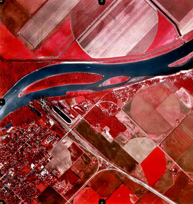
Infrared Aerial Photo
Infrared aerial photos are made with cameras either digitally or with film that is sensitive to infrared light rays. The uses for infrared aerial photos vary from tracking rainfall, to migratory patterns of animals.
http://www.umesc.usgs.gov/data_library/gis_data/aerial_photos/1994_illinois_river_72dpi/la_grange/187-013-lg-1994.jpg
No comments:
Post a Comment
Newer Post
Older Post
Home
Subscribe to:
Post Comments (Atom)

No comments:
Post a Comment